Attention: Sign up to get 100 credits for free!
GPS Location Image Generator
See any place as it looked throughout history. Enter GPS coordinates, choose an era from 3000 BC to today, and generate documentary-style photographs of locations across time.
50 credits | 30-60 seconds

Free GPS Location Image Generator
Create stunning GPS location images by entering coordinates, choosing an era from 3000 BC to today, and generating documentary-style photographs of any location throughout history. Our GPS location image tool brings history to life.
Or enter a specific year...
Describe a specific event or scene, or leave blank to show the general atmosphere of the era
0/300 characters
Our GPS location image generator is a revolutionary time machine for any place on Earth. Enter coordinates for the Colosseum and see it during the Roman Empire using our advanced gps location image technology. Visit medieval Paris or 1920s New York with precise historical accuracy. Unlike traditional stock photos limited to modern times, this gps location image tool recreates historical scenes with documentary-style photorealism. Perfect for history educators bringing lessons to life, documentary filmmakers needing reference imagery, authors researching settings for historical fiction, travelers who want to create tourist selfies at famous landmarks, and anyone curious about how places transformed across millennia. For those who want to see both eras in a single seamless image, try our then and now photo generator that creates stunning time-space fusion. If you want magazine-cover-style travel posters featuring yourself at any destination, our travel poster design generator creates professional travel content with GPS coordinates. The gps location image generator makes it easy to create gps photo location visuals spanning 5000 years with customizable watermarks showing coordinates, era, and location names.
How GPS Location Images Work: Step-by-Step Process
Convert GPS location images from coordinates to detailed historical visualizations in four simple steps. Learn how the gps location image process works.
Pick Your Location
Enter any GPS coordinates or select from famous landmarks worldwide
Choose Your Era
Select a time period from 3000 BC to present day using preset eras or fine-tune to any specific year
Set the Scene
Add optional context like "busy marketplace" or "after a storm" to guide the generation
Generate & Download
Get your documentary-style historical photograph in 30-60 seconds
Historical Visualization Examples
Explore iconic locations across different eras using our advanced GPS location image technology and gps location image generator - from ancient civilizations to modern history
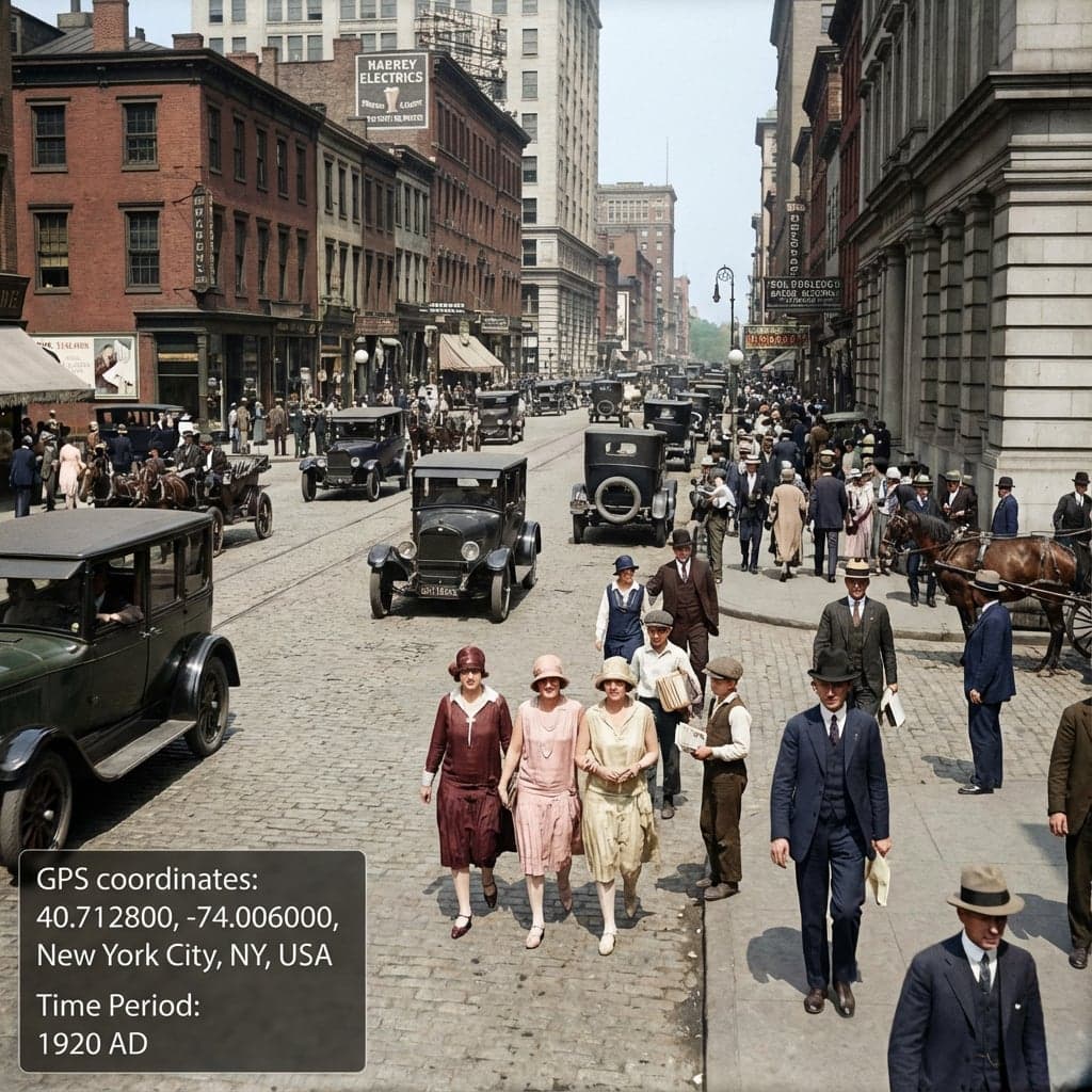
Manhattan during the Jazz Age
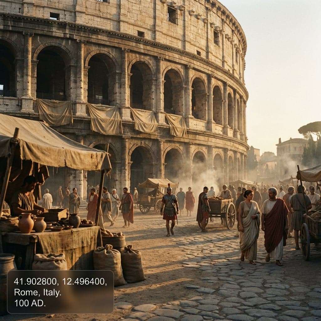
Colosseum in its glory
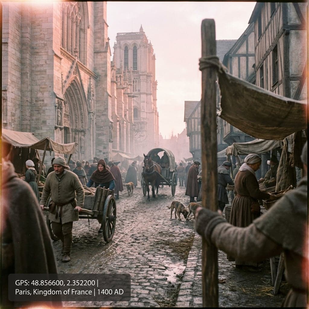
Gothic architecture era
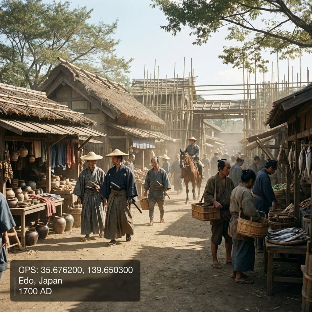
Samurai-era marketplace
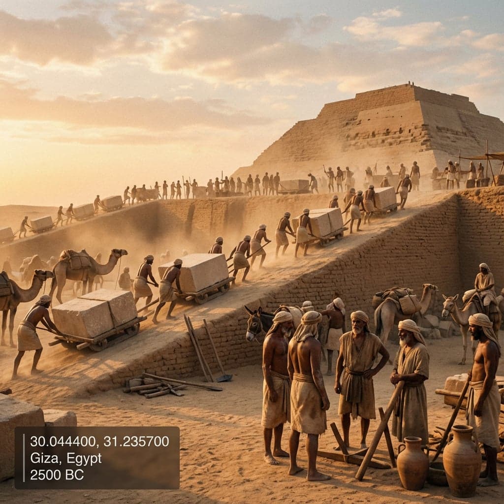
Great Pyramid construction
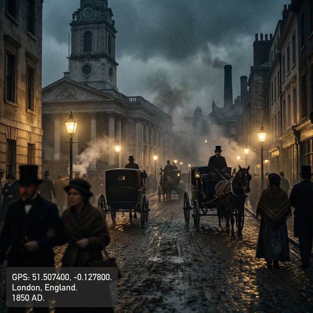
Industrial Revolution cityscape
Tip: Each GPS location image generation is unique and customizable. Add scene context like "busy marketplace" or "during a festival" to guide your gps location image visualization.
Who Uses GPS Location Image Generators
Educators, filmmakers, authors, and curious minds use our powerful gps location image generator and gps location image tool to explore locations throughout history
History Education
Bring history lessons to life by showing students exactly how locations looked in different time periods. Visualize ancient civilizations, medieval towns, and industrial-era cities using GPS location image technology.
- Ancient Rome classroom materials
- Industrial Revolution visual aids
- World War II location studies
Documentary & Film
Create reference images for historical documentaries, period films, and video essays. Generate authentic-looking historical scenes without expensive set reconstruction.
- Period film location scouting
- Documentary B-roll references
- Historical video essay visuals
Authors & Worldbuilders
Visualize settings for historical fiction, alternate history, or any story grounded in real places. See your novel's setting as it would have appeared in your chosen era using the GPS location image generator.
- Historical fiction research
- Setting visualization for novels
- Alternate history worldbuilding
Personal Heritage
Discover how your ancestral hometown or family's origin looked generations ago. Connect with your heritage by visualizing the world your ancestors knew using GPS location image technology.
- Ancestral hometown in the 1800s
- Immigration-era port cities
- Family origin location history
AI Coordinate Image Generator Features
Powerful features for building detailed historical location visualizations with our cutting-edge gps location image generator
Any GPS Coordinates
Create GPS location images from any latitude/longitude coordinates worldwide
5000 Years of History
Travel from 3000 BC to present day with preset eras or fine-tune to any specific year
Scene Context Control
Add descriptive context like "crowded festival" or "winter morning" to customize your scene
Documentary-Style Realism
All images generated in photorealistic documentary style for authentic historical feel
High Resolution Output
1024x1024 images with optional coordinate and era watermarks for reference
Commercial Use Rights
Full rights to use generated images for educational materials, publications, and commercial projects
GPS Scene Generator vs Alternatives
See how our gps location image generator and gps location image solutions compare to traditional options for location visualization
| Feature | Our Tool | Stock Photos | Street View | AI Art Tools |
|---|---|---|---|---|
| Any coordinates | ||||
| Historical time periods | ||||
| Documentary-style output | ||||
| Scene context control | ||||
| Coordinate watermark | ||||
| Commercial rights |
Flexible Credit Packages
Choose the package that fits your visualization needs
55 images package
- GPT-Image-1: 55 images (10₵/image)
- Nano Banana: 27 images (20₵/image)
- Nano Banana Pro: 11@1K / 9@2K / 6@4K (50-80₵/image)
- 550 credits total
- 6+ artistic styles
- Up to 4K resolution (4096×4096)
- Commercial usage rights
120 images package
- GPT-Image-1: 120 images (10₵/image)
- Nano Banana: 60 images (20₵/image)
- Nano Banana Pro: 24@1K / 20@2K / 15@4K (50-80₵/image)
- 1200 credits total
- 6+ artistic styles
- Up to 4K resolution (4096×4096)
- Commercial usage rights
300 images package
- GPT-Image-1: 300 images (10₵/image)
- Nano Banana: 150 images (20₵/image)
- Nano Banana Pro: 60@1K / 50@2K / 37@4K (50-80₵/image)
- 3000 credits total
- 6+ artistic styles
- Up to 4K resolution (4096×4096)
- Commercial usage rights
Frequently Asked Questions
Everything you need to know about GPS location image generation
What time periods can I generate?
Our GPS location image generator covers over 5000 years of history, from 3000 BC (Age of Pyramids) through Classical Antiquity, Medieval times, Renaissance, Industrial Revolution, and up to the present day. You can select from preset eras like "Medieval 500 AD" or "Industrial 1800" or use the fine-tune slider to pick any specific year within the range.
How historically accurate are the generated images?
The AI creates documentary-style visualizations based on historical research and architectural knowledge of each era. While not photographs of actual historical moments, the images capture accurate period architecture, clothing, technology, and atmosphere typical of each time period and location. Think of them as historically-informed artistic reconstructions.
Can I generate images of locations before they existed?
Yes, that's one of the most powerful features. Generate an image of Manhattan in 1500 AD to see the pre-colonial landscape, or view the site of modern Tokyo during the medieval Edo period. The AI adapts to show what the geographic location would have looked like before modern development.
What coordinate formats are supported?
We support standard decimal degree format (e.g., 40.7128, -74.0060). Enter latitude values between -90 and 90, and longitude values between -180 and 180. You can also use the interactive map to click any location, or select from quick-access buttons for famous world landmarks.
Can I customize what appears in the scene?
Yes, the "Scene Context" field lets you describe what's happening in your image. For example, add "busy market day" for a bustling medieval town, "after a battle" for a war-torn landscape, or "early morning fog" for atmospheric effects. This helps the AI generate more specific and evocative scenes.
How is this different from Google Street View or stock photos?
Google Street View only shows modern photographs of places their cameras have visited. Stock photos are limited to whatever photographers happened to capture. Our GPS location image generator creates AI visualizations of ANY coordinates at ANY point in history - see 1920s Paris, ancient Athens, or medieval London on demand, with consistent documentary-style quality.
🔗 Related AI Tools
Explore more creative AI-powered image generators and style transformation tools
Nano Banana Pro
NEW!Studio-quality AI image generator powered by Google Gemini 3 Pro with 2K/4K resolution support
Anime Hybrid Portrait Generator
NEW!Blend realistic photos with Japanese anime elements - companions, magical objects, energy effects
Chibi Plush Generator
PopularTransform photos into adorable chibi plush toy style with soft textures
Character Figurine Generator
PopularCreate detailed character figurines with professional 3D modeling aesthetic
Pop Art Vector Portrait
NEW!Transform photos into vectorized flat-color pop art with Andy Warhol aesthetics
Bottle Diorama Generator
PopularTransform into a tiny figure trapped in hyper-realistic glass bottle worlds
Start Your GPS Location Image Journey Through Time
Transform any location into a window to the past using our gps location image tool. From ancient civilizations to yesterday's world - see history like never before.
50 credits per generation
Contact Us
Have questions or suggestions? Feel free to get in touch